11 UK Counties to Miss First Mini-Heatwave of 2026
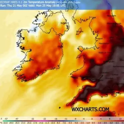
Advanced weather maps from WX Charts, utilizing Met Desk data, indicate that the United Kingdom is poised to experience its first mini-heatwave of the year this week. However, not all regions will bask in the warm conditions, with 11 specific counties set to miss out entirely on the balmy 24C temperatures forecasted for parts of England.
Forecast Details and Affected Areas
The meteorological projections reveal rising temperatures across Tuesday, April 7, and Wednesday, April 8, 2026. A distinctive yellow, orange, and red hue on the weather maps illustrates the spread of warmth, primarily concentrated in the south, south east, south west, Midlands, and Home Counties. Despite this widespread heat, the following 11 counties are expected to be spared the soaring mercury:
- Rutland
- Isle of Wight
- Lancashire
- Greater Manchester
- Herefordshire
- Cumbria
- Northumberland
- Durham
- Westmorland
- Cheshire
- Cumberland
According to the Met Office forecast spanning from April 7 onwards, "Plenty of very warm sunshine once again across much of England and Wales, with temperatures well above average. Mostly dry for Northern Ireland and Scotland though generally cloudier here."

Weather Pattern Changes and Cooling Trends
The outlook for Thursday to Saturday indicates a shift in conditions, with "Gradually turning wetter and windier across the north and west on Thursday. Likely staying warm and dry in the southeast." By Friday and Saturday, the forecast predicts colder, wetter, and windier weather for all regions.
BBC forecaster Simon King elaborated on this change, stating, "The weather pattern will change on Wednesday night and Thursday and temperatures will be falling. A band of rain will push southeastwards across the whole country to be followed by sunshine and showers and a north-westerly wind."
He further explained that this shift in wind direction will introduce much cooler air, causing temperatures to drop noticeably to around 10 to 14C (50-57F) across most areas. However, ahead of the rain, temperatures in East Anglia and south-east England could still reach 20C (68F).
Looking ahead, high pressure is expected to nudge back in on Friday, bringing dry weather and sunshine back to England and Wales. Nevertheless, more cloud and rain will head into Scotland and Northern Ireland later, heralding a transition to a more changeable weather pattern across the UK.