
The United Kingdom is preparing for another bout of severe winter weather this weekend, with fresh warnings for snow and ice issued just days after the devastating impact of Storm Goretti. The storm, which brought 99mph winds and record snowfall, has left a trail of disruption, with tens of thousands of properties still without electricity and transport networks in chaos.
Fresh Wintry Hazards on the Horizon
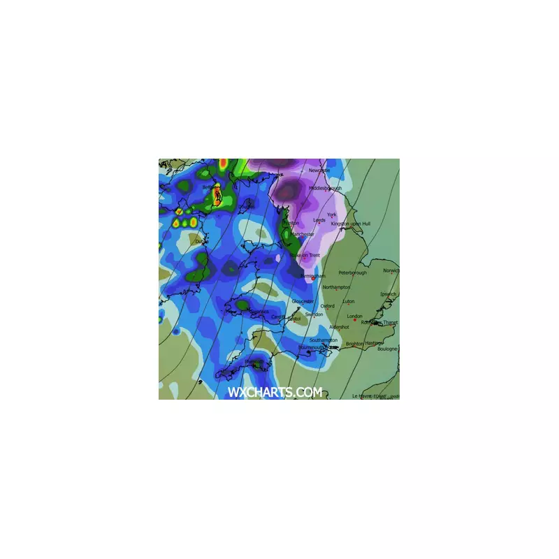
While Saturday offered a brief, drier respite, forecasters warn this will be short-lived. A new band of rain and snow is predicted to sweep across the country from the early hours of Sunday morning. This system is expected to bring significant snowfall, with higher ground in the north potentially seeing accumulations of 10 to 20cm.
As this precipitation hits the lingering cold air, it will create a widespread risk of snow and a dangerous 'glaze' of ice on untreated roads and pavements. The Met Office has issued a yellow weather warning for snow and ice, valid from 2.00am until 3.00pm on Sunday, January 11, 2026. This alert covers almost all of Scotland and large swathes of northern England.

Ongoing Fallout from Storm Goretti
The immediate aftermath of the storm continues to cripple parts of the country. Emergency services and local authorities remain on high alert. The most pressing issue is the widespread loss of power. As of 6.00am on Saturday, approximately 28,000 homes in the South West were without electricity, joined by 1,700 in the West Midlands and 150 in the East Midlands.
Travel disruption remains severe across the rail network. Major operators including Transport for Wales, West Midlands Railway, Great Western Railway, and CrossCountry are all reporting significant alterations and cancellations to their services. This follows a day of ice-related alerts across southern, western, and northwestern England.
Record Cold and Future Risks
Storm Goretti plunged temperatures to extreme lows, with Braemar recording a frigid -12.3°C. Forecasters now warn of a 'severe frost' and treacherous icy patches as the cold persists. Furthermore, the combination of melting snow and incoming rain raises the spectre of flooding in the coming days.
The storm's ferocious gale-force winds caused extensive damage, bringing down trees and leading to flight cancellations. Dramatic footage emerged of a passenger plane swaying violently while attempting to land at Heathrow Airport. Although the core of the storm has now moved eastwards, the entrenched cold air ensures that winter hazards will dominate the remainder of the weekend, keeping emergency responders and the public on alert.


