
The Met Office has escalated weather concerns by issuing a new yellow warning for 23 specific areas across England and Wales, set to take effect on Thursday. This alert highlights significant risks from melting snow and persistent rainfall, which could lead to widespread surface water flooding and travel disruptions.
Warning Details and Expected Impacts
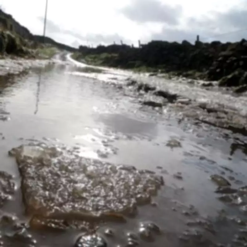
The 19-hour yellow weather warning, active throughout Thursday, forecasts periods of rain and heavy showers that are likely to cause surface water flooding in numerous locations. The Met Office has emphasised that spray and flooding on roads will probably extend journey times, with bus and train services also expected to face delays. Additionally, there is a possibility of brief interruptions to power supplies and other essential services.
In its official statement, the Met Office noted: "Rain arriving from the south overnight Wednesday into Thursday is likely to turn heavy and persistent in places for a time during Thursday morning." Following a temporary respite for many areas, albeit with some heavy showers lingering, a further organised area of rain is anticipated to arrive from the south, affecting the same regions once again.

Precipitation and Flooding Risks
Accumulations of 10-20mm of rain are predicted to fall fairly widely by the end of Thursday, with some spots potentially exceeding 30mm. Given the already saturated ground conditions across much of the country, low-impact surface water flooding is deemed probable. This situation is expected to create difficult driving conditions due to spray, flowing water, or flooded roads.
Aidan McGivern, a meteorologist from the Met Office, provided further insight: "One band of rain and hill snow moves north, before more rain moves in overnight. Slightly milder air will come in from the south, with snow confined to the peaks and northern Scotland." He added that strong south-easterly winds will feel raw, even as temperatures turn slightly less cold with the rising snow level.
List of Affected Areas
The following 23 areas are under the new snow warning, with residents and travellers advised to stay vigilant:
- Hampshire
- Isle of Wight
- Portsmouth
- Southampton
- West Sussex
- Bournemouth Christchurch and Poole
- Cornwall
- Devon
- Dorset
- Plymouth
- Somerset
- Torbay
- Wiltshire
- Blaenau Gwent
- Caerphilly
- Merthyr Tydfil
- Monmouthshire
- Powys
- Rhondda Cynon Taf
- Torfaen
- Herefordshire
- Angus
- Aberdeenshire
This warning underscores the importance of monitoring local updates and preparing for potential disruptions, as the combination of melting snow and heavy rain poses a dual threat to communities across the UK.


