
Met Office Issues Snow Warning for Multiple English Counties
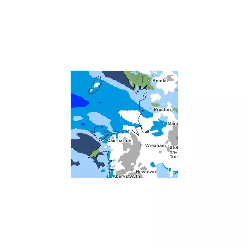
The Met Office forecasting service has released updated weather maps indicating that eleven counties across England could experience significant snowfall before Wednesday, January 28th. The meteorological agency has highlighted the return of wintry conditions, with maps displaying extensive white coverage across northern and central regions of the country.
Affected Counties and Timing
According to the latest Met Office projections, the most severe weather is anticipated to strike during the early hours of Tuesday morning. From approximately 3am on Tuesday, January 27th, the following areas are identified as being at potential risk:
- Greater Manchester
- Lancashire
- Durham
- Yorkshire
- Cumbria
- Staffordshire
- Shropshire
- Herefordshire
- The West Midlands conurbation
- Swathes of Nottinghamshire
- Cheshire
The meteorological maps have transformed to white as a substantial patch of wintry precipitation spreads southward from northern England toward the Midlands region.

Detailed Weather Forecast
The Met Office has provided comprehensive forecasts for the coming days. For Saturday, January 24th, they report: "Wet and windy conditions will persist in western areas. Rain or hill snow continues to affect parts of central and eastern Scotland, while eastern England remains mostly dry with occasional sunny spells. Elsewhere, expect frequent showers or prolonged periods of rainfall. Windy conditions will affect all regions, with gales gradually easing in some areas."
The forecast continues: "Unsettled weather patterns will dominate, particularly in western regions, with additional bands of rain or showers moving northward. Eastern areas will remain mostly dry but often cloudy. Rain and hill snow will ease across northeast Scotland. Many areas will experience cloudy conditions with outbreaks of rain or showers, though some brighter intervals may develop, with numerous regions becoming drier later. Further hill snow remains likely across parts of northeast Scotland."
Extended Outlook and Additional Forecasts
The Met Office outlook for Monday through Wednesday indicates: "Unsettled conditions will persist throughout this period, with bands of rain moving north and east across the country. Tuesday is expected to see particularly challenging weather as another deep area of low pressure approaches from the southwest. Temperatures will feel notably cold."
Complementary forecasts from the BBC align with this assessment, predicting windy and wet conditions in the southwest today, with spells of rain and breezy weather in northeast Scotland accompanied by hill snow. Most other regions will remain predominantly dry with variable cloud cover, though Northern Ireland will also experience periods of rainfall.
Residents across the affected counties are advised to monitor weather updates closely and prepare for potential travel disruptions and hazardous conditions as this wintry weather system develops across England.


