
Storm Ingrid Approaches: Met Office Issues Critical Weather Warnings
The Met Office has escalated its weather alerts as Storm Ingrid prepares to batter the United Kingdom with severe conditions. The national weather service has issued yellow weather warnings for 23 specific regions across southwest England and Wales, urging residents to take immediate precautions.
Potential Danger to Life from Flooding and High Winds
Forecasters warn that torrential rainfall combined with 60mph winds could create life-threatening situations, particularly due to flooding risks. The ground in many affected areas is already saturated from previous rainfall, increasing vulnerability to water accumulation and potential property damage.
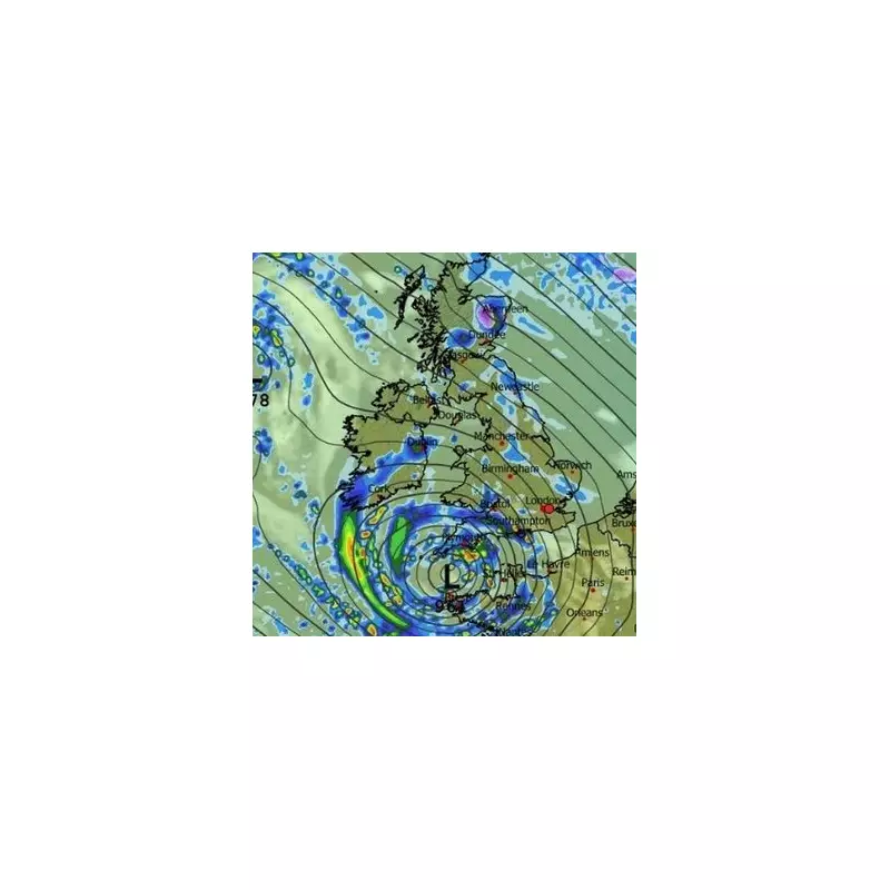
Neil Armstrong, the Met Office's chief forecaster, explained the meteorological situation: "An area of low pressure, named Storm Ingrid by the Portuguese national weather service, will bring spells of heavy rain and strong winds across much of southwest England on Friday before easing on Saturday morning."

Emergency Preparedness: Creating Your Flood Kit
The Met Office has specifically advised residents in the affected regions to prepare emergency flood kits in advance of the storm's arrival. This recommendation comes as part of broader guidance about how to cope with potential power outages and travel disruptions.
Essential items for an emergency kit should include:
- Torches with spare batteries
- Mobile phone power packs or portable chargers
- Essential medications and first aid supplies
- Important documents in waterproof containers
- Non-perishable food and bottled water
The weather service emphasized: "People cope better with power cuts when they have prepared for them in advance. It's easy to do; consider gathering torches and batteries, a mobile phone power pack and other essential items."
Warning Duration and Affected Regions
The Met Office's yellow weather warning will be active from 2am on Friday, January 23 through to 9am on Saturday, January 24. During this period, residents can expect the most intense conditions before rainfall and wind speeds gradually decrease.
Forecasters predict that some areas could receive up to 40mm of rainfall, with many locations experiencing at least 20mm. Coastal regions face additional hazards from large waves and particularly strong gusts, while inland areas may experience winds reaching 45-50mph.
Complete List of Affected Areas
The following regions in southwest England and Wales are under the Met Office's weather warning:
South West England:
- Cornwall
- Devon
- Dorset
- Isles of Scilly
- North Somerset
- Plymouth
- Somerset
- Torbay
Wales:
- Blaenau Gwent
- Bridgend
- Caerphilly
- Cardiff
- Carmarthenshire
- Merthyr Tydfil
- Monmouthshire
- Neath Port Talbot
- Newport
- Pembrokeshire
- Powys
- Rhondda Cynon Taf
- Swansea
- Torfaen
- Vale of Glamorgan
Residents in these areas are strongly encouraged to monitor weather updates, check their property's flood risk, and complete their emergency preparations before the storm's arrival early Friday morning.


