Fresh weather mapping data has revealed the projected path of a new wintry system that could bring substantial snowfall to Birmingham and surrounding regions later this month. The latest meteorological charts suggest a major snow event is developing, with the potential to disrupt parts of the UK during the middle of February.
Timeline of the Approaching Snow System
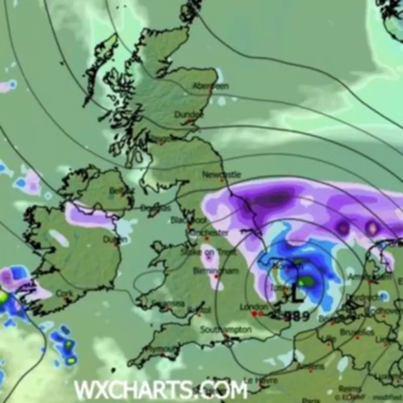
According to current forecast models, the initial phase of this weather pattern will see a concentrated snow bomb affect southern and south-eastern England during the evening of Monday, February 16. This system is then expected to track northwards overnight, reaching Birmingham and other Midlands areas by the early hours of Tuesday, February 17.
Expected Snowfall Accumulations
Forecasters indicate that some locations could receive up to two inches of fresh snowfall, though accumulation will depend heavily on ground temperatures and precipitation intensity. While widespread snow is anticipated across many regions, most areas are likely to see only around an inch of light snowfall. The critical question remains whether conditions will be cold enough for snow to settle on lower ground, particularly in urban areas like Birmingham.

Broader Weather Patterns for Late February
The Met Office has provided extended forecasts covering the period leading up to February 18, noting that rainfall amounts will probably be highest in western regions, including areas already vulnerable to flooding concerns. As weather fronts move northwards, snow becomes increasingly possible across northern England and Scotland, primarily affecting higher elevations.
Meteorological experts also warn that strong winds could develop in various locations, particularly around coastal areas. Temperature predictions suggest conditions will generally remain close to seasonal averages overall, with any notably cold spells more likely to occur in northern parts of the country.
Looking Further Ahead
Forecasts for the period beginning February 19 indicate that changeable conditions will persist across the United Kingdom. Low pressure systems are expected to dominate the weather pattern, bringing showers or prolonged periods of rain to much of the UK. Some hill snow remains possible in northern regions during this time.
The Met Office adds that periods of strong wind may continue, especially around coastal zones. Temperature projections suggest values will likely hover around average or slightly above normal for the time of year, though local variations will occur depending on specific weather systems and geographical factors.
Residents across Birmingham and the wider Midlands region are advised to monitor updated weather forecasts closely as this potential snow event approaches, particularly regarding travel implications and any weather-related advisories that may be issued.