UK Braces for Major Winter Blast as 500-Mile Snow Band Approaches
Weather maps have revealed that the United Kingdom is set to face a significant winter weather event next week, with a 500-mile snow band forecast to sweep across the country. This disruptive system is expected to bring heavy snowfall and dangerously low temperatures, impacting travel and daily life.
Timeline and Extent of the Snowfall
According to forecasts from WXCharts, the snow band will begin to affect the UK from Tuesday evening, February 17, 2026, and continue into Wednesday morning, February 18. The band is predicted to stretch from northern Scotland all the way down through northeast England and the Midlands, potentially reaching as far south as London and Southampton.
Snow depth modelling indicates that lower-level areas could see accumulations of 2 to 5 centimetres, while higher elevations such as the Pennines and Scottish Highlands may experience locally heavier snowfall of 5 to 10 centimetres. This widespread snow event is driven by a surge of polar air moving southwards across the UK.

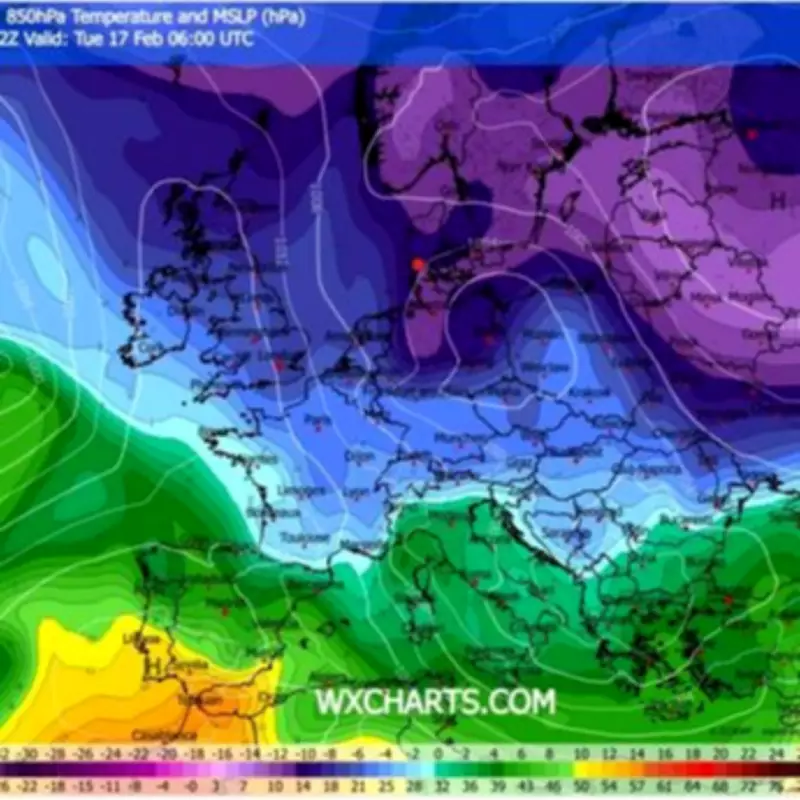
Dangerous Temperature Drops Expected
Temperatures are forecast to plummet to perilous levels alongside the snowfall. Rural areas in Scotland and northern England are likely to face the brunt of the cold, with temperatures dropping to between -8°C and -10°C. Even central and southern England are not immune, with temperatures expected to hover near or below freezing, making for hazardous conditions.
Upper air temperature maps show a pool of Arctic air spreading south across the UK, which is responsible for this intense freeze. The combination of snow and sub-zero temperatures raises significant concerns for public safety and infrastructure.
Travel Disruptions and Safety Warnings
Motorists are advised to exercise extreme caution, as untreated roads are at high risk of developing ice and black ice, especially after the snowfall clears. The Met Office has issued warnings about continued unsettled weather through late February, including showers, strong winds, and occasional snow in northern regions.
While the most disruptive conditions are anticipated across northern Britain, small shifts in the weather front could alter the affected areas, meaning residents across the UK should stay informed and prepared. This winter blast underscores the importance of monitoring weather updates and taking necessary precautions during severe cold spells.