The Met Office has released detailed weather maps indicating that significant parts of the United Kingdom are set for wintry conditions this week, with snow flurries expected to sweep across all four Home Nations.
Where and when will the snow arrive?
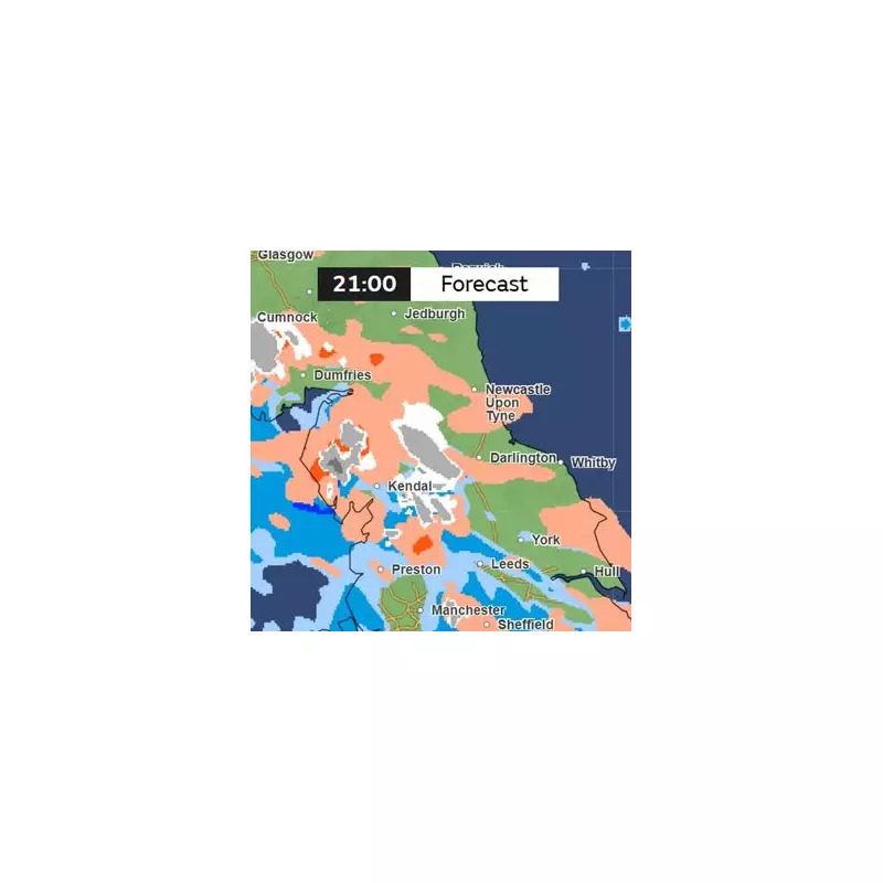
According to the latest charts, the initial snowfall is forecast to begin on the evening of Friday, December 5. The first flurries are predicted to hit south west England, Wales, and Northern Ireland.
As the evening progresses, the wintry weather is expected to extend its reach. By 9pm on Friday, light to moderate snow is anticipated across Scotland and several counties in England. The English regions identified as being at risk include:

- Derbyshire
- Yorkshire
- Staffordshire
- Cumbria
- Northumberland
- Durham
Furthermore, Greater Manchester and Lancashire could also experience patches of snowfall.
Weekend outlook and weather warnings
The Met Office indicates that the snow may linger into the early hours of Saturday, December 6, before turning to rain around 6am. Their official outlook for the weekend states: "Further spells of rain and showers will move across the country. A risk of fog patches for many on Friday morning. Temperatures around the seasonal average."
Expert analysis on the winter ahead
Looking beyond the immediate forecast, weather experts are monitoring broader atmospheric patterns. Netweather TV has provided analysis on the stratospheric polar vortex (SPV), a key driver of winter weather.
They report that during December and early January, the SPV is forecast to be weaker than average. This condition makes it more susceptible to events like sudden stratospheric warming (SSW), which can disrupt the vortex and increase the chance of prolonged cold spells and blocking weather patterns over high latitudes.
However, Netweather notes a current disconnect between the stratospheric and tropospheric polar vortex. This means the lower atmosphere is following its own path for now, with the tropospheric vortex positioned over northern Canada in early December. The stratospheric vortex, meanwhile, appears displaced toward the Barents Sea due to ongoing warming.
Their early winter prediction adds a note of caution: "But there is potential that there may be coupling between the stratosphere and troposphere later in winter." This could have significant implications for the UK's weather as the season deepens.