
The Met Office has issued a fresh warning as an Arctic blast is set to return to the UK, bringing a sharp drop in temperatures and potential snowfall to parts of England this weekend.
Counties on alert for wintry conditions
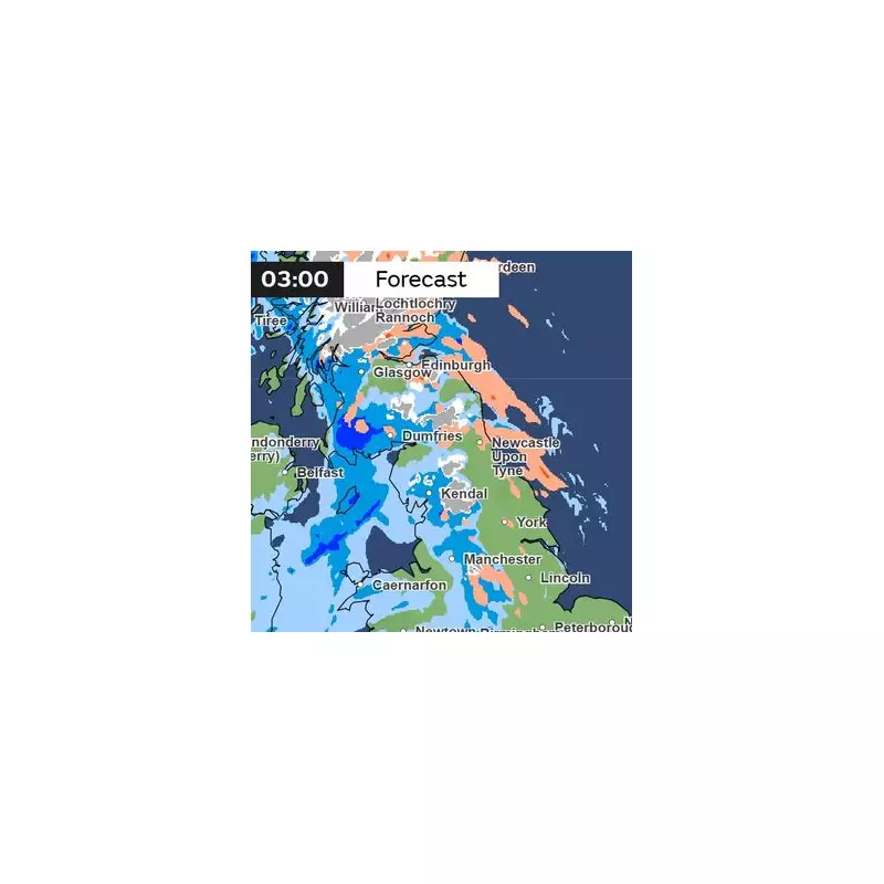
Weather maps from the forecaster indicate that six counties could see wintry flurries, with the white stuff most likely to fall on Sunday. The areas identified as being at risk include Lancashire, parts of Greater Manchester, Cheshire, and Cumbria. Further north, Northumberland and Durham could also be hit.
The Met Office has emphasised that any significant snow accumulation will probably be confined to high ground in the north. For most areas, temperatures are expected to remain around the seasonal average despite the chilly shift.

Forecaster's detailed outlook
In a statement to The Independent, a Met Office spokesperson sought to manage expectations, stating: “There’s no significant snow in the current forecast period, with a mild westerly regime in charge bringing a mixture of sunny spells and periods of rain through this week.”
The forecaster did acknowledge a small chance of sleet over Scottish mountain tops later in the week but confirmed there is no signal for snow at lower levels in the immediate forecast.
Looking at the broader picture for the UK, the period is expected to be dominated by changeable and unsettled conditions. The Met Office attributes this to low pressure systems that are likely to bring rain, with some heavy bursts or showers expected, particularly in western regions.
The official forecast adds: “Periods of strong wind are possible, especially around coasts and if any deep areas of low pressure form in the vicinity of the UK. Some short-lived spells of drier weather are possible, particularly in the South East. Temperatures will likely be close to average or slightly above overall.”
BBC Weather's weekend forecast
Echoing the unsettled theme, the BBC forecasts spells of rain for the north and west on Thursday, accompanied by increasing south-westerly winds. The south-east will be drier but cloudy, with the odd shower possible.
Its outlook for Friday to Sunday confirms the turbulent pattern: “Unsettled on Friday with showers or longer spells of rain for many, these heavy across western areas. Some wintriness is possible on the northern Scottish hills early on.”
Saturday is expected to see heavy rain move across England and Wales, with strong winds along the south coast. While the north may stay drier, Sunday is predicted to be windy with rain affecting eastern parts of the country, capping off a weekend where residents in the north should keep a watchful eye on the sky.


