An intense amber weather warning has been issued for the West Midlands as Storm Claudia unleashes torrential rain and powerful winds across the region. The storm, which was initially named by the Spanish Meteorological Service, is creating hazardous conditions, particularly in Birmingham and the Black Country.
Immediate Impacts and Travel Disruption
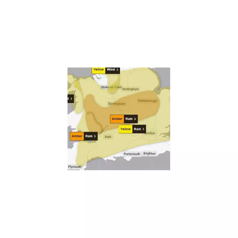
The Met Office's amber alert, a rarer and more severe warning, came into force at noon on Friday, November 14, and is scheduled to remain active until just before midnight. The warning highlights a significant danger to life from fast-flowing or deep floodwater.
Travel chaos is already unfolding across the region. West Midlands Railway has confirmed major disruptions, including the suspension of all services between Worcester and Hereford. Furthermore, the busy Cross City line will see a reduced frequency of just two trains per hour. Bus cancellations are also expected as the adverse conditions continue.

Met Office Forecast and Extended Warnings
According to the national weather agency, the storm is set to bring persistent and heavy downpours throughout Friday. Forecasters predict widespread rainfall of 40-60 mm, with some areas, particularly in the East Midlands and on higher ground, potentially seeing accumulations of around 80 mm.
The impacts are likely to be worsened by strong easterly winds and the potential for thunderstorms later in the afternoon and evening. The Met Office has warned that some communities could be cut off by floodwater and that driving conditions will be extremely hazardous due to spray and flowing water.
While the most severe amber warning expires at midnight, a less severe yellow warning for rain will persist until 6am on Saturday, indicating that the persistent wet weather is expected to continue overnight, potentially leading to further disruption.