


Community

Bright Ways Community CIC Expands with New Premises and £5,000 Grant
Bright Ways Community CIC, supporting older adults with memory challenges, moves to Enderby Leisure Centre and receives £5,000 from Persimmon Homes North Midlands.


Business

Gtech Combi Drill Bundle: Cordless Power Tool Deal UK
Gtech's combi drill bundle offers a cordless power tool set for DIY enthusiasts. Save on this multi-tool kit with hammer action and accessories.


Culture

Disney Boss: Bristol Integral to Rivals Season 2 Success
Disney says the West of England and Bristol were integral to the success of Rivals Season 2, now streaming on Disney Plus, with 90% of locations filmed locally.


Politics

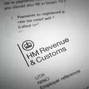
DWP Warns 3.9 Million PIP Claimants: 10 Days Left to Respond to Timms Review
The DWP urges all 3.9 million PIP claimants to share their views in the Timms Review before the May 28 deadline. The review aims to reform the benefit for future needs.


Sport


Health

Survivor Speaks Out After Restaurant Manager Jailed for Abuse
A sexual abuse survivor has bravely spoken out after Richard Tung, a respected restaurant manager, was jailed for 12 years for abusing him as a child.

Esthederm Adaptasun Sunscreen SPF Review
Our review of Institut Esthederm Adaptasun sunscreen SPF 50+ reveals excellent protection, lightweight texture, and skin-friendly ingredients. Perfect for daily use.
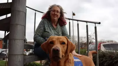
Woman with long Covid and heart failure gets assistance dog Jeff
Emma Reardon, 53, from Carmarthen, who has Ehlers-Danlos Syndrome, long Covid, and heart failure, says her disability assistance dog Jeff, trained by Support Dogs, has transformed her life.
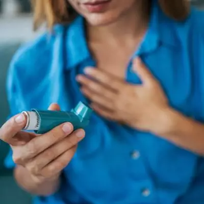
DWP Lists 26 Respiratory Conditions for £114 Weekly PIP
The DWP has released a list of 26 respiratory conditions that may qualify for Personal Independence Payment (PIP) of up to £114.60 per week, providing vital support for daily living tasks.

Epsom Grandmother, 104, Celebrates with Garden Party
Beatrice Whiteman marked her 104th birthday at Epsom Beaumont care home with a stylish garden party, live music, and family joining from Australia via video call.
