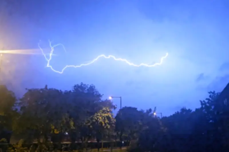
The Met Office has issued a yellow thunderstorm warning for Birmingham and the West Midlands, with forecasts indicating potential lightning strikes, heavy rain, and travel disruption. The warning is in effect from early afternoon until late evening, covering a wide area across the region.
What to Expect
According to the Met Office, thunderstorms could develop rapidly, bringing frequent lightning, gusty winds, and sudden downpours. Rainfall amounts could reach 20-30mm in an hour, with some locations seeing up to 50mm. This may lead to surface water flooding, particularly in urban areas and on roads.
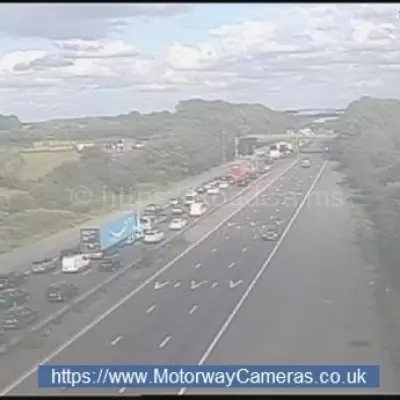
Travel Disruption
Travel disruptions are likely, including delays to train and bus services. Drivers are advised to be cautious on the roads, as heavy rain can reduce visibility and increase stopping distances. Some roads may become temporarily closed due to flooding or fallen debris.

Safety Advice
The Met Office advises people to stay indoors during the worst of the weather, avoid using electrical appliances, and steer clear of windows. If caught outside, avoid open fields, hilltops, and isolated trees. Lightning can strike up to 10 miles from a storm, so it's important to seek shelter as soon as thunder is heard.
Regional Impact
Areas affected include Birmingham city centre, Solihull, Coventry, Wolverhampton, and surrounding towns. The warning also extends to parts of Staffordshire, Warwickshire, and Worcestershire. Residents are urged to secure loose garden furniture and check on vulnerable neighbors.
The thunderstorms are expected to move eastwards through the evening, with conditions improving by nightfall. However, further showers are possible overnight and into the next day. The Met Office will continue to monitor the situation and update warnings as necessary.
For the latest updates, follow the Met Office on social media or check their website. Stay safe and plan ahead if traveling in the affected areas.