Birmingham Faces Icy Hazard as Freezing Temperatures Trigger Met Office Alert
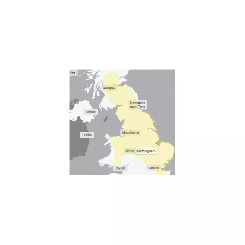
The Met Office has activated a yellow weather warning for ice across Birmingham and the wider West Midlands region, with temperatures forecast to drop to freezing levels overnight. This alert highlights the potential for hazardous conditions as patchy ice forms on untreated surfaces, which could lead to significant disruption for residents and commuters.
Timing and Impact of the Weather Warning
The warning is scheduled to be in effect for a ten-hour period, commencing at midnight and extending through to 10am on Wednesday, January 28. During this time, the Met Office advises that untreated roads, pavements, and cycle paths may become slippery, increasing the risk of accidents and travel delays. Motorists and pedestrians are urged to exercise extra caution, particularly during the early morning hours when ice is most likely to form.
In addition to the ice warning, the Environment Agency has issued a series of flood alerts, with 120 flood warnings currently active across the UK, including one severe warning indicating a danger to life in Devon. A further 230 flood alerts have been disseminated, underscoring the broader unsettled weather patterns affecting the nation.

Detailed Forecast for the West Midlands
The Met Office's regional forecast for the West Midlands outlines a wet and windy start to Wednesday morning, with heavy rain and potential gales in exposed areas. Snow is also anticipated over the Peak District, adding to the wintry conditions. As the day progresses, the rain and hill snow are expected to ease, although windy conditions will persist, with a maximum temperature reaching 9°C.
Overnight, clear spells and blustery showers will give way to drier conditions, with temperatures dropping to a minimum of 3°C as winds subside. Looking ahead to Wednesday daytime, the region can expect a dry and bright day with sunny spells, feeling more pleasant despite a southerly breeze, and a high of 8°C.
Extended Outlook and Safety Advice
The weather is predicted to remain unsettled through Thursday to Saturday, with often cloudy skies, intermittent rain, and breezy conditions. Residents are encouraged to stay updated with the latest forecasts and travel advice, especially given the combined risks of ice and flooding. Local authorities may implement gritting operations on key routes to mitigate the icy hazards, but individuals should take personal precautions, such as wearing appropriate footwear and allowing extra time for journeys.
This alert serves as a reminder of the volatile winter weather impacting the UK, with Birmingham and the West Midlands particularly susceptible to icy disruptions. By heeding official warnings and planning ahead, the community can better navigate these challenging conditions safely.