Met Office Issues Yellow Ice Warning for Birmingham and Black Country
An ice warning has been issued for large parts of the country, including the entire West Midlands region, as temperatures are expected to drop significantly. The alert specifically covers Birmingham, the Black Country, Solihull, Coventry, Staffordshire, Warwickshire, and Worcestershire.
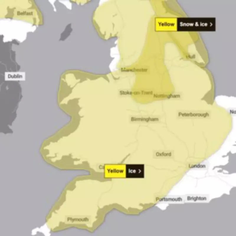
Warning Details and Timing
The yellow ice warning is in effect from 5pm on Friday, February 13, through to 10am on Saturday, February 14. This warning extends across Wales and into the north west and north east of England. The Met Office has cautioned that icy surfaces will lead to difficult travel conditions during this period.
The Met Office stated: "A band of rain and sleet, with a little snow on hills, will clear southwards across England and Wales during Friday evening and overnight. As skies clear, temperatures will fall below freezing leading to a risk of ice forming on untreated surfaces."

Travel Advice and Safety Precautions
Residents are urged to take extra precautions when venturing out during the icy conditions. The Met Office has provided specific guidance to help people stay safe:
- Plan to leave home at least five minutes earlier than usual to avoid rushing and reduce the risk of accidents, slips, and falls.
- When walking, try to use pavements along main roads, which are more likely to be less slippery.
- Cyclists should stick to main roads that have likely been treated for ice.
- Drivers should check road conditions before traveling, and those using public transport should consult bus and train timetables to amend plans if necessary.
Additional Snow and Ice Warning
A separate warning for snow and ice has also been issued by the Met Office, affecting parts of Staffordshire and Stoke-on-Trent. This alert is in place from 9pm on Saturday, February 14, to 10am on Sunday, February 15.
The warning map indicates that the affected area includes Stoke, parts of Derby, and Nottingham, extending just north of Lichfield, Rugeley, and Hednesford. However, it does not reach Birmingham or the Black Country.
The alert states: "Snow, heavy at times, may cause some disruption to travel, especially over high ground during Saturday night and Sunday morning."
The Met Office explained that outbreaks of rain spreading eastwards on Saturday night will initially fall as snow, even at low levels, before becoming confined to higher ground as milder air arrives from the west. Temporary snow accumulations of 1-3 cm are possible at low levels, with 3-7 cm possible above about 150 meters elevation, and up to 10-15 cm above 400 meters.
Ice will be an additional hazard, particularly in northeast England and parts of Scotland where precipitation may fall on frozen ground, creating very slippery conditions. The snow is expected to turn to rain by Sunday morning, possibly as a short spell of freezing rain in some areas, before clearing to the east with a steady thaw of lying snow.