UK Braces for New Snow Wave as Arctic Front Approaches This Week
A new weather system is poised to bring another round of unsettled conditions to the United Kingdom, with snowfall expected to begin as early as Wednesday, February 18, and a blizzard forecast for Scotland and northern England on Thursday evening. This development follows a weekend of wintry weather that has already caused disruptions across the nation.
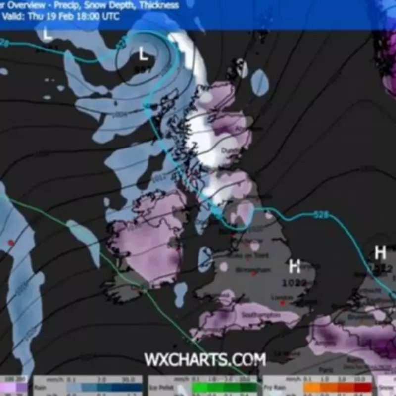
Timeline of the Incoming Weather Front
Multiple weather warnings have been in place nationwide since Friday, offering only a brief respite on Monday before the winter woes return. The latest bout of inclement weather is scheduled to arrive on Wednesday, with snow predicted to blanket the UK by Wednesday evening. According to the ECMWF weather model, Northern Ireland, Wales, and western England could be the first regions affected on that day.
The snowfall is anticipated to persist into Thursday, with up to nine inches of accumulation expected across the Scottish Highlands. The snow is also projected to sweep across much of central and northern England, creating hazardous travel conditions. This frigid weather front is even forecast to unleash a blizzard along Scotland's west coast and northern England from approximately 6pm on Thursday, stretching from Glasgow to Carlisle.

Current Weather Conditions and Flooding Impact
The opening two days of the week, preceding this arctic blast, are not expected to offer sunshine and clear skies, providing no reprieve from the dreary conditions. Unsettled and blustery weather with showers nationwide is forecast to commence on Monday, gradually subsiding into Tuesday. Following 74 flood warnings and 162 flood alerts across England on Sunday morning, Jonathan Day, the flood duty manager at the Environment Agency, revealed that whilst over 24,000 homes and businesses have been safeguarded, approximately 330 have been inundated.
A snow warning is also in effect for parts of eastern England until 4pm today. The alert cautions that "a spell of snow may lead to some disruption to travel." The warning elaborates: "Rain moving eastwards through Sunday morning is likely to turn increasingly to sleet and snow. Slushy accumulations of 1cm or so are likely, with a chance of 2-4cm should snow turn briefly heavier, this more likely for the Lincolnshire Wolds and parts of Norfolk and Suffolk."
Long-Range Forecast and Outlook
The weather outlook does not appear to improve following this weekend's flurry of warnings and the mid-week snowstorm. The Met Office's long-range forecast from Friday, February 20, to Sunday, March 1, stated: "Showers or longer spells of rain, as well as occasional strong winds, are most likely at first as Atlantic low pressure systems dominate in the vicinity of the UK. Heavy rainfall is expected in places, with some snowfall probable at times, primarily on high ground in the north. Temperatures will fluctuate from around, or slightly above, average particularly in the south to cold at times, mainly in the north."
Although unsettled weather is likely to dominate at first, there will be some drier interludes between weather systems. These drier interludes will become increasingly likely and perhaps more prolonged through the period. Residents are advised to stay updated on local weather alerts and prepare for potential travel disruptions as the new wave of snow approaches.