Britain is on alert for a potential major winter storm, with forecasters monitoring the development of a significant snow event that could sweep across the country later this month. Advanced weather models are indicating the possibility of a 600-mile-wide 'wall of snow' arriving from the east, drawing comparisons to the infamous 'Beast from the East' of 2018.
Timeline and Potential Impact of the Snow Event
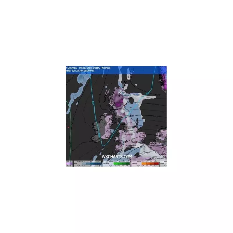
According to long-range GFS weather models, the disruptive weather front is currently forecast to arrive around Friday, January 23, 2026. The system is expected to bring widespread snowfall that could stretch from the southern coast of England all the way to the far north of Scotland.
The snowfall is predicted to persist throughout Saturday, January 24, and Sunday, January 25, with the weather system likely to extend its reach into Wales and Northern Ireland as it moves across the nation. Weather maps currently highlight that flurries could begin in major urban centres around midday on the 23rd.

Cities in the Path and Expected Snow Accumulation
Forecasters have identified twelve principal cities that are most likely to be affected by this potential late-January blast. Aside from the Scottish Highlands, the urban areas facing possible disruption include:
- London
- Bristol
- Cardiff
- Birmingham
- Nottingham
- Norwich
- Manchester
- Newcastle
- Edinburgh
- Glasgow
- Dundee
- Aberdeen
While the term "Beast from the East" is being used due to the storm's eastern origin, current predictions suggest accumulations will be less extreme than the 2018 event. The heaviest snow is anticipated in Scotland, with up to 8 inches possible, while other regions may see roughly 1 to 2 inches.
Forecast Uncertainty and Current Weather Context
Authorities and meteorologists are emphasising that uncertainty remains high for predictions this far in advance. The BBC Weather long-range outlook has adopted a more cautious tone, noting that the chance of "meaningful" snow is currently considered low.
However, they acknowledge that a shift in high pressure over Scandinavia could be the trigger for these colder, snowy conditions, and this development is a key factor to keep an eye on for the end of the month.
This long-range warning comes as the UK remains under an amber cold health alert. Temperatures have already plunged dramatically this week, reaching a low of -12.3°C in some parts of the country, and the nation is still recovering from the significant disruption caused by the recent Storm Goretti.
Residents across the UK are advised to stay updated with the latest forecasts from the Met Office and local authorities as the potential storm's path becomes clearer in the coming days.