UK Braces for Two Weeks of 'Above Normal' Sunshine and Rising Temperatures
The United Kingdom is poised for a notable shift in weather patterns, with forecasts predicting two weeks of 'above normal' sunshine and a substantial temperature increase of up to 10°C. According to data from WX Charts, which utilizes the GFS modelling system, conditions are expected to improve significantly between April 20 and April 22, marking the start of a prolonged warm spell.
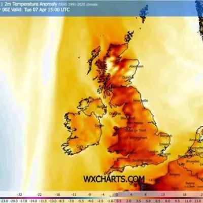
Temperature Surge and Regional Variations
Maps from WX Charts have turned yellow, indicating maximum temperatures exceeding 20°C in the south-east and London areas. The predictions highlight a dramatic rise, with temperatures set to climb by 10°C from Wednesday, April 15, when highs of 10°C are anticipated, to Wednesday, April 22, when they are forecast to double. From Monday, April 20 onwards, temperatures are projected to linger in the 20s for three consecutive days, offering a taste of early summer warmth.
Looking ahead to the end of April and into early May, NetWeather TV provides further insight. The period from April 20 to May 5 is forecast to feature above-average pressure, particularly over northern Britain, leading to drier conditions across most UK regions, especially in the north and east. Probabilities favor above-average temperatures for the majority, though easterly or south-easterly winds may keep North Sea coasts cooler than inland areas.

Sunshine and Weather Patterns
Sunshine levels are likely to be above normal for most parts of the UK, with exceptions in some North Sea coastal areas and the south-west, where conditions may be near normal. NetWeather TV notes that while high pressure will dominate, it probably won't be consistent throughout, allowing for possible wetter interludes, mainly in western and southern Britain. Specifically, sunshine is expected to be above average in the east and near to slightly below in the west and south-west.
Short-Term Forecast Context
In the short term, the Met Office forecast for Sunday, April 12, describes a day of sunny spells and blustery showers, with a continued risk of hail and thunder, particularly in the north and west. It will feel chilly with strong gusty winds. The outlook for Monday, April 13, onwards indicates further showers but lighter winds, followed by brighter conditions at first on Tuesday with rain arriving later and moving erratically eastwards during Wednesday. Despite average temperatures, it should feel pleasant in the sunshine, setting the stage for the upcoming warm period.
This forecast suggests a welcome break from cooler weather, with the UK experiencing enhanced sunshine and warmer temperatures as April progresses, potentially impacting outdoor activities and daily life across the nation.