
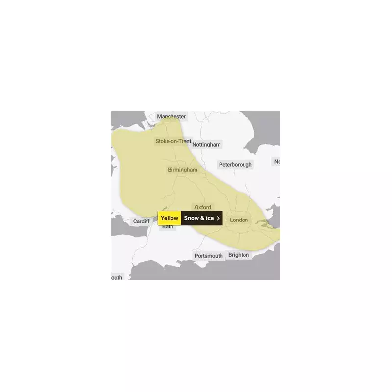
The Met Office has ushered in the new year with a significant yellow weather warning for snow and ice, covering Birmingham, the Black Country, and vast areas of England and Wales. Forecasters predict a band of wintry precipitation will sweep across the region, potentially disrupting travel in the early hours of Friday, 2 January 2026.
Timeline of the Wintry Blast
The national forecaster expects a band of sleet and snow to move south-eastwards from Wales and the North West, reaching the West Midlands around midnight on New Year's Day. For Birmingham and the Black Country specifically, the chance of snow is forecast to begin around 11pm, rising to an 82% probability by 3am on Friday. The wintry conditions are expected to last for two to three hours in any one location before clearing.
Where snow settles, accumulations of 1 to 2cm are likely, with the potential for up to 5cm on higher ground in parts of north Wales and northwest England. The Met Office has cautioned that icy patches will form rapidly in the wake of the clearing snow and sleet.

Travel Advice and Safety Precautions
With the warning in place, residents are urged to take extra care. The weather agency advises planning to leave home at least five minutes earlier to avoid rushing on potentially slippery surfaces. Pedestrians should stick to main road pavements which are more likely to be gritted, and cyclists are similarly advised to use treated routes.
For drivers, essential preparations are key. The Met Office recommends checking road conditions and public transport timetables before setting out. A well-stocked car should include:
- Warm clothing, food, water, and a blanket
- An ice scraper and de-icer
- A torch, warning triangle, and high-visibility vest
- An in-car phone charger
Wider Impact Across the Country
The yellow warning stretches from northern and central Wales through the North West and the entire West Midlands region. It also extends into parts of the East Midlands, including Derbyshire and Leicestershire, and reaches the south east, encompassing areas of Kent and Hampshire.
The forecast for the West Midlands tonight indicates clear and dry conditions initially, but cloud will increase, bringing the chance of sleet or snow showers, making for a cold start to Friday. The public is advised to stay updated with the latest forecasts and travel information as the situation develops.


